If the structures of Cydonia are intelligently created, then the most important question we can ask is not simply whether they exist, but why. What is their purpose?
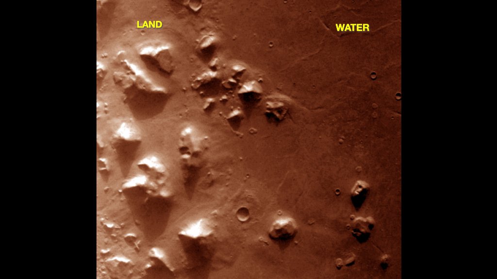
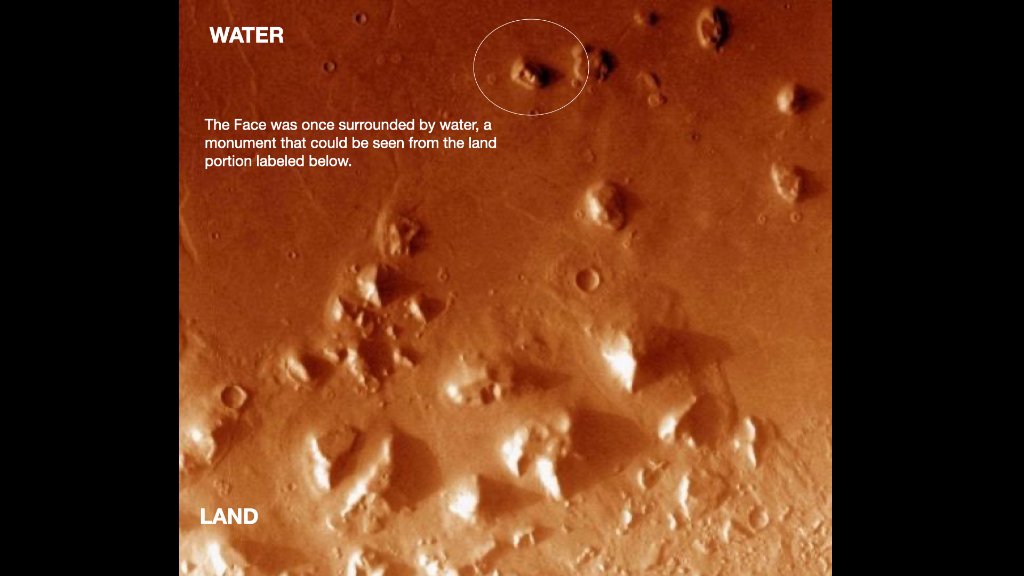
When you look closely at the image above, you can clearly see what appears to be a terrain difference right at about where a shoreline would be if the city was on the edge of land. The Face is positioned in a way that would be visible from the city. So are other key features in this region, like the D&M pyramid.
Is this just coincidence? NOPE. The geology alone speaks for itself.
Why We Build at the Water's Edge
Throughout human history, our greatest civilizations have almost universally chosen to build their most important cities at the water's edge. There is a reason for this. Water means life — it means trade, transport, food, and connection. But there is something more. There is a deeper draw to the waterfront that goes beyond survival. We are drawn to it.
Consider Venice, built on a lagoon, its palaces and churches rising directly from the water. Or Alexandria, founded on a narrow strip of land between the Mediterranean and a lake, with its legendary lighthouse guiding ships to the greatest library of the ancient world. Constantinople — modern Istanbul — was built precisely where the sea meets the land, commanding the trade routes between two continents.
Think of Amsterdam, a city literally carved from the sea, its grand canal houses facing the water. Singapore, a trading empire built on a harbor. Dubai, which transformed a desert shoreline into one of the most valuable waterfront real estate on Earth. Manhattan, a island where the most expensive property is that which faces the harbor.
Even pre-dynastic Egypt built Memphis at the apex of the Nile Delta. The Mesopotamians built Ur on the Euphrates. The Minoans built Knossos near the coast of Crete. From Cape Town to Rio de Janeiro to Mumbai, the pattern repeats across every continent and every era: we build where the land meets the water, and we orient our most important monuments to be visible from that water.
The Shoreline of Cydonia
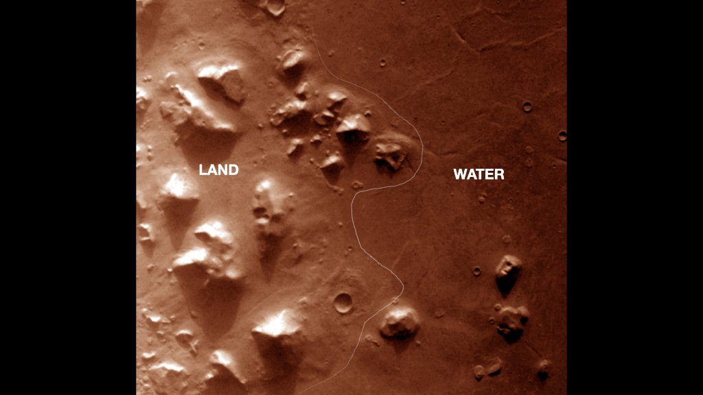
Now look again at Cydonia. When you examine the terrain closely, a boundary emerges — a distinct transition between the high-relief, rugged formations on one side and the flat, smooth expanse on the other. A hand-drawn line traces this transition, and it falls exactly where a shoreline would be.
This is not a random geological accident. The Face on Mars sits within this boundary zone. The D&M pyramid, the City, and the other anomalous structures cluster along this same edge. They are oriented along the transition between land and basin.
If these structures were placed by an intelligence, then their arrangement along this terrain boundary is exactly what we would expect of a civilization building at the water's edge.
A Monument by the Sea
The Face was once surrounded by water — a monument that could be seen from the land portion labeled below. Look at the layout. The Face occupies a position that would have made it visible from the flat basin, as well as from the elevated city structures to the west. This is the same logic that drove the placement of the Pharos at Alexandria, the pyramids at Giza, and the statues of Easter Island: monuments are positioned to be seen.
Whether or not the surface difference is caused by water, I am not able to say, since I am not a geologist. The sedimentary layering, the smooth basin floor, the sharp terrain transition — these are observations, and their interpretation belongs to the specialists. But in my opinion, just by looking at the image myself and the anomalies in the region, the evidence is compelling.
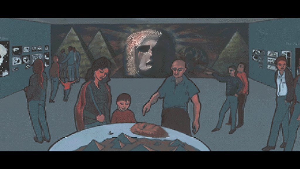
It seems quite possible that Cydonia was built right at the edge of water. Just like we do on Earth, with waterfront property.